Day 28: (05/15): to 361.7 :: 14.5 miles
Friday 5/15
We wait until morning to get water from the cache since we had enough to get us through the night. I stay at the campsite while Jeff goes over to get the water. It it less than a minute walk. Jeff saw a hiker go by just a few minutes before, and when he arrives to the cache that hiker was squatted down pooping within view of the cache! Jeff grabs one of the water jugs and walks away with it to give the guy some privacy. Shortly after, another guy shows up. Both guys are super ultra light backpackers, and one of them is just hiking a section and hasn’t brought any sleeping gear! Apparently in that situation, you just walk until you’re exhausted and lay down where ever until you get too cold and then you get up and walk again! The two hikers begin to brag back and forth about who could be more ultra light and Jeff uses that opportunity to slip away.
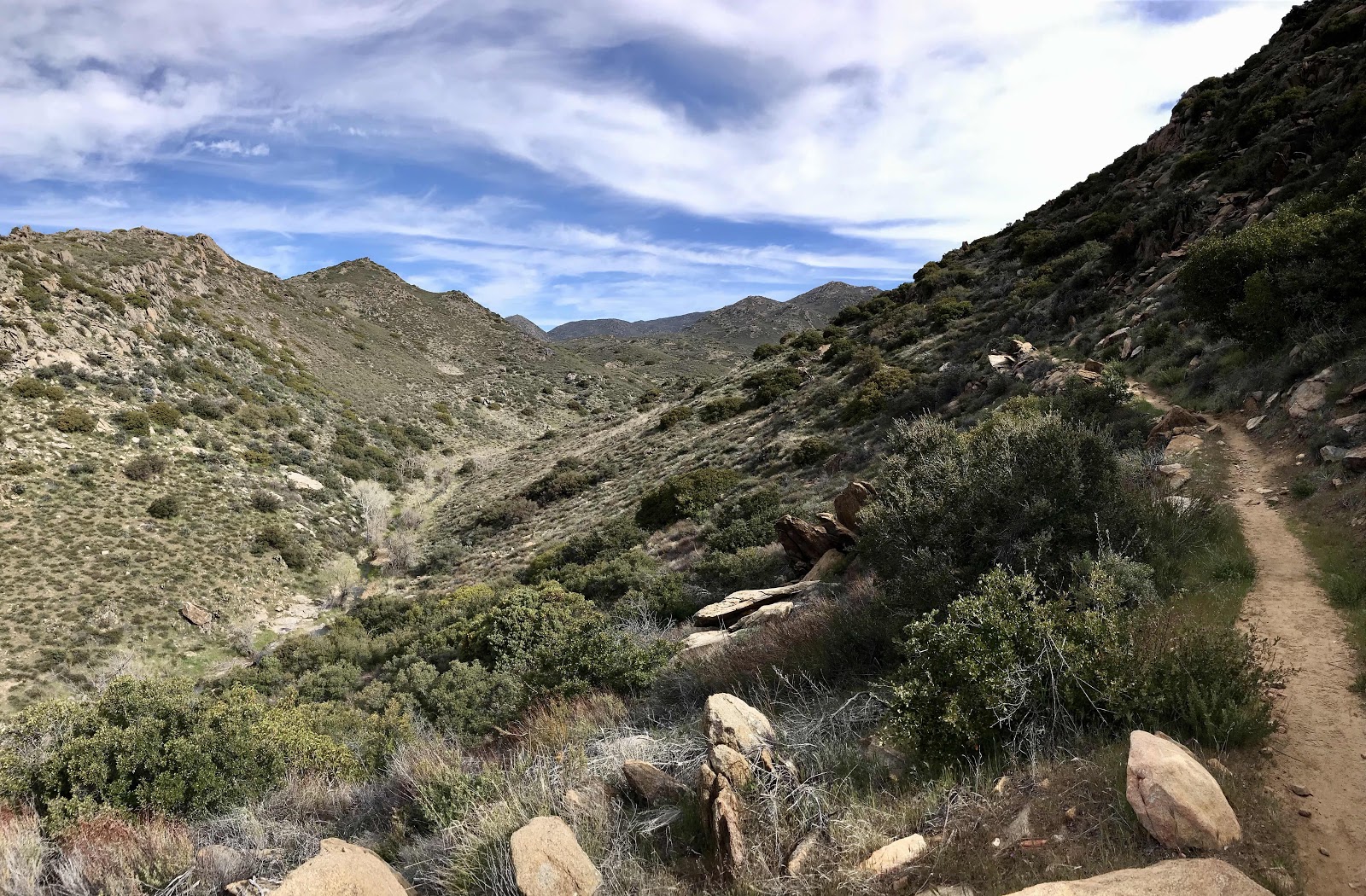
We will have no access to water all day, so we stock up to near capacity, 9 liters. With our food weight so low, we barely notice the water weight and are able to keep up a good pace. We left camp much later than usual and take many breaks along the way, cooking food several times and we still managed to be done hiking early and make it 14.5 miles. We hike along a ridge all day through a forest fire burn zone of a few years ago, so there isn’t much shade to be had. The higher we climb the more our view expands, to eventually include Cajon Pass and the towns on either side, plus the San Bernardino mountains of the Big Bear area, all the way back to San Jacinto and even some San Diego County mountains and the Mojave Dam area from a few days ago too! It’s quite impressive!
Because we walk on a steep slope just below the ridge top most of the day, there aren’t many flat spots to rest. We get creative at lunch, climbing off the trail to the road above and attaching our umbrellas to some burned out trees for shade. We are quite proud of this ingenuity, but almost have to forfeit it when we are suddenly swarmed by bees!! We actually leave our stuff and run down the road. Luckily they linger just a few minutes, then fly over the ridge and disappear! There must have been a couple thousand of them! The trail is near and often parallel to dirt roads all day, you could drive them and get just about the same views as from the trail. We see a few vehicles on the roads throughout the day.
We could have made it to Wrightwood tonight if determined but we don’t have a reservation until tomorrow, so we stop 1.6 miles before the junction down to town. We make it high enough in elevation and far enough from the burn zone to get back up into the pine forest and get a nice view of the valley below. As it is getting dark a couple hikers show up. We always face our tent door away from the trail for privacy, but one guy walks right up and basically sticks his head in our tent and says “who do we have here??” I thought that was extremely rude and ignored him, letting Jeff do the talking instead. I kind of hate talking to other hikers because it always comes down to comparing each other. They want to know when you started, how many miles a day you hike, how many days off you’ve had and when you’ll get to Canada. I pretty much assume they will all be faster than us for now and don’t care to get to know them and be interviewed by them, especially awkwardly from my tent! The number of hikers seems to be going up as corona virus restrictions are lifting, but officially, the PCTA still recommends staying home and postponing your through hike. There was a trail register at the water cache and we saw that 7 hikers signed it yesterday and 11 the day before. We have seen about 10 hikers going the other way so far this leg. Many of them probably skipped ahead to the Mojave desert section during the big storm last month and are now back tracking down to where they left off.
Sunrise view at camp
Really nice water cache on the side of Lone Pine Canyon Road, it’s a quick drive for the people in Wrightwood who maintain it.
View back down the valley toward Cajon Pass and San Bernardino. Mountains on the far right in the smog are San Gorgonio, San Jacinto and other mountains further south.
A tiny horned lizard. He didn’t seem to mind hanging out in Jeff’s hand.
Mt Baldy visible behind the ridge that we walk below all day. You can see the cut of the dirt road near the top of the ridge.


Our lunch spot on the ridge.
Following the ridge.
Lone Pine Canyon and the North and South bound lanes of I-15 in the distance. In the far distance, you can see some desert towns, like Hesperia.
San Gorgonio and San Jacinto in the distance.
Looking back at the dirt road along the ridge. What a neat place to drive a vehicle!


Getting out of the burn zone and into some nice high elevation forest! We enjoy the transition zones, desert yucca meets high elevation fir forest!
The next valley over from Lone Pine Canyon, there’s a road down there too.
Lilacs and snowy mountains near Wrightwood.
Some elaborate barricades and moguls where the trail crosses a dirt road at Gobblers Knob. These were in place at every road crossing today to keep people from trying to go off-roading on the PCT. We stopped in the shade here for a meal and a guy in a fancy truck with all the gear and gadgets you could imagine drove up and interviewed us, but didn’t share any snacks or refreshing beverages!
A homemade cous cous meal kit that I assembled at home. Very good and filling too. Whole wheat cous cous with curry spices, coconut butter, sliced almonds and dried cherries.
One more panorama of the view.


You can really see the path of pollution out of the LA basin. It basically starts at Santa Monica and the prevailing westerly winds off the ocean blow pollution away from the western side of LA to the eastern side and then the San Gabriel and Pomona Valleys. Most of it winds up in a wad at San Bernardino, where it just sits until strong desert winds scatter it, or blow it someplace else (Las Vegas gets a lot of it, somehow). The pollution seems to stay below 3000-4000 feet, so you get to hike in refreshingly clean air.
ReplyDelete