Friday 5/22
Our exposed campsite on the ridge makes for nice sunrise views and also allows direct sunlight into our camp earlier than normal. This causes us to wake up earlier and get going faster too, since we aren’t freezing. We are already walking by 6:15. We beat Super Hiker out of camp, but she quickly overtakes us and then we never see her again. Both times we saw her, she looked as if she was running down the trail. Some people hike so fast we wonder how they even enjoy it. Do they take the time to look around?
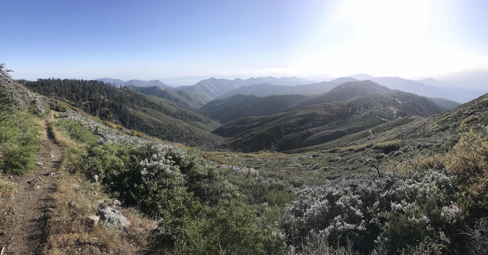
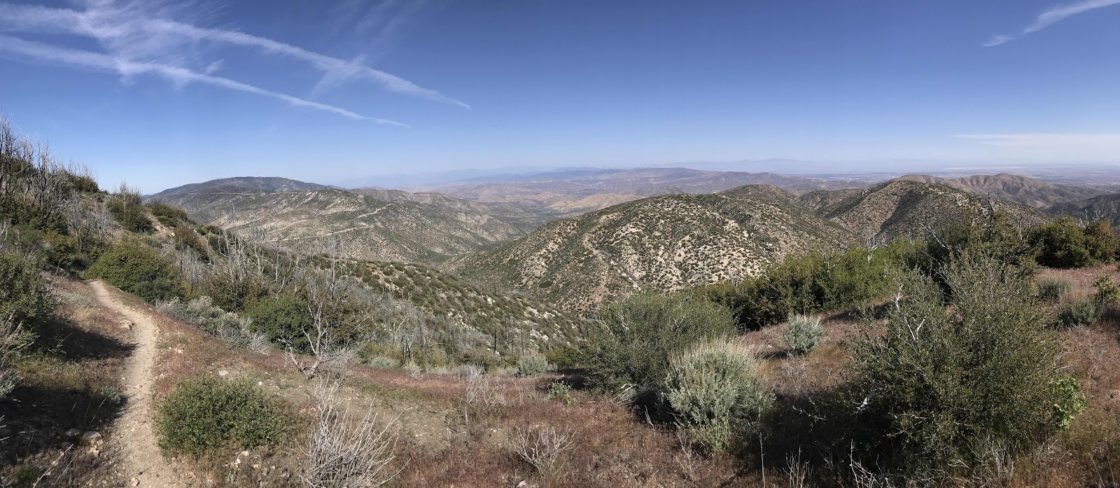
We traverse around Pacifico mountain away from the Angeles Crest view and start angling toward a view of the valleys to the North like Agua Dulce and Acton, our next layover points. We stop for breakfast before we begin the descent and enjoy the views of layer upon layer of mountains to the North. It's crystal clear and we are probably looking several weeks into our future terrain! After breakfast, we begin down a slow steady grade off of Pacifico Mountain to the crossing of the Angeles Forest Highway near the Mill Creek Fire Station, an entity of the USFS. There is a trailhead parking lot, a picnic area, water faucet, pit toilets and trash cans. We have experienced that most pit toilets are closed during this time, and these are no different, but the water faucet is running and that is far more important to us. Some hikers camp here and have pizza delivered from somewhere down the highway.
Hikers get really excited to have access to pit toilets and I’ve spent a lot of time wondering why. I’ve figured out that I think it must be for getting rid of the bag of poo paper that they carry around. Rather than bury toilet paper in a cat hole along with the poop, you are supposed to pack it out. That sounds really disgusting, but animals will dig it up and it’s not nice to see toilet paper all over the wilderness. I have often wondered what percentage of hikers resist the temptation to bury it and actually pack it out like they are supposed to. I think some burn it in their campfires, but I don't even want to know what that smells like! We don’t have to worry about this, as we use a water sprayer bottle, similar to a bidet for toileting purposes.
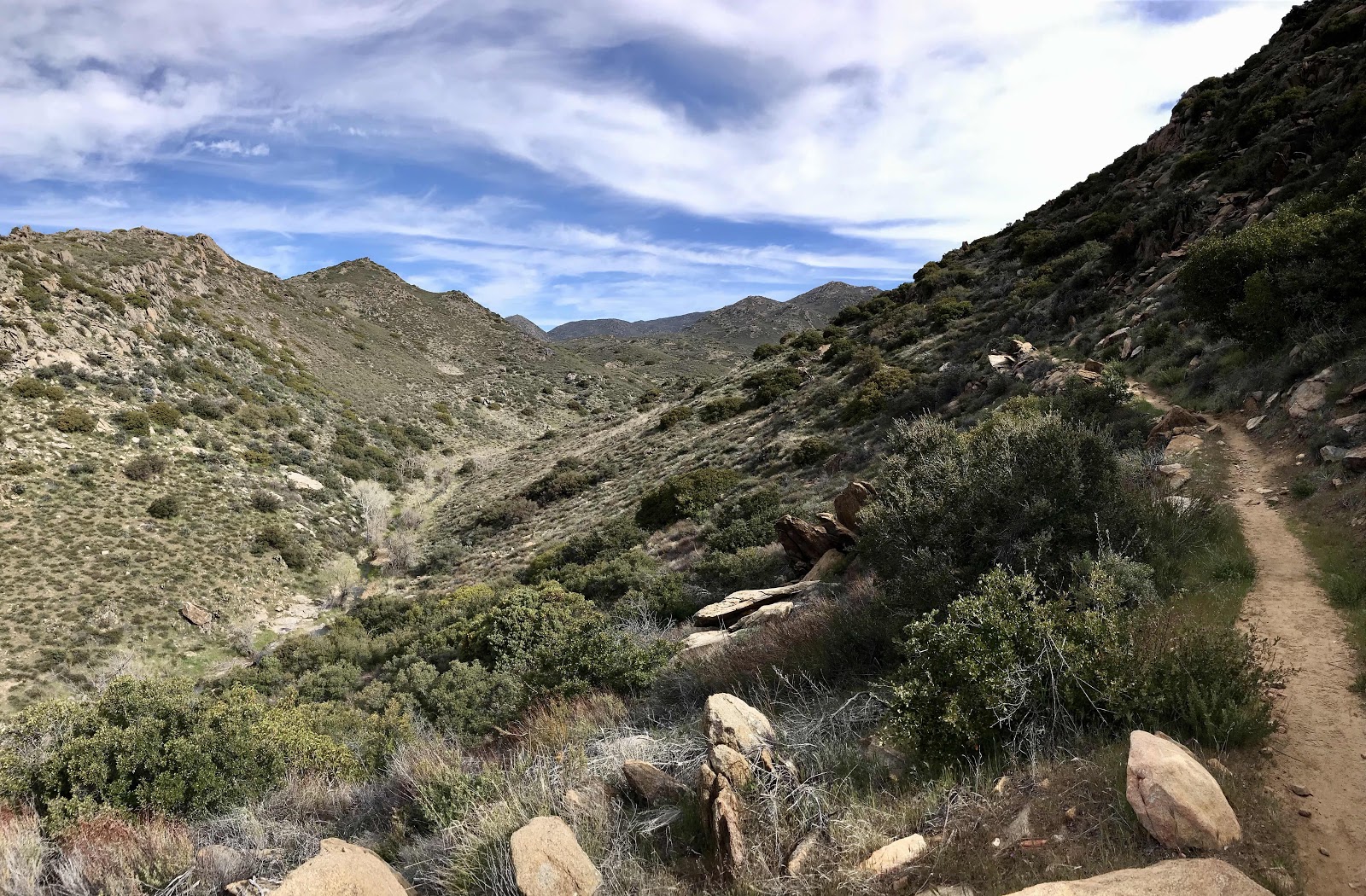
After a quick stop for water refill, we cross the highway and continue up the next mountain, Mt Gleason. Just like the descent, it is a slow, steady meandering climb. All day we hike through the Station Fire burn zone from 2009. This was apparently the biggest fire in Los Angeles County history and 10th largest in California history. We’ve sure hiked though a lot of burn zones, most of which occurred in the last 10 years or so. We can’t help but keep thinking this would have been great to have been doing this hike 10+ years ago. I know forest fires are supposed to be good for the land in terms on regeneration, but it’s a shame that so many have occurred in such short succession and it seems the fire seasons keep getting longer and more intense.
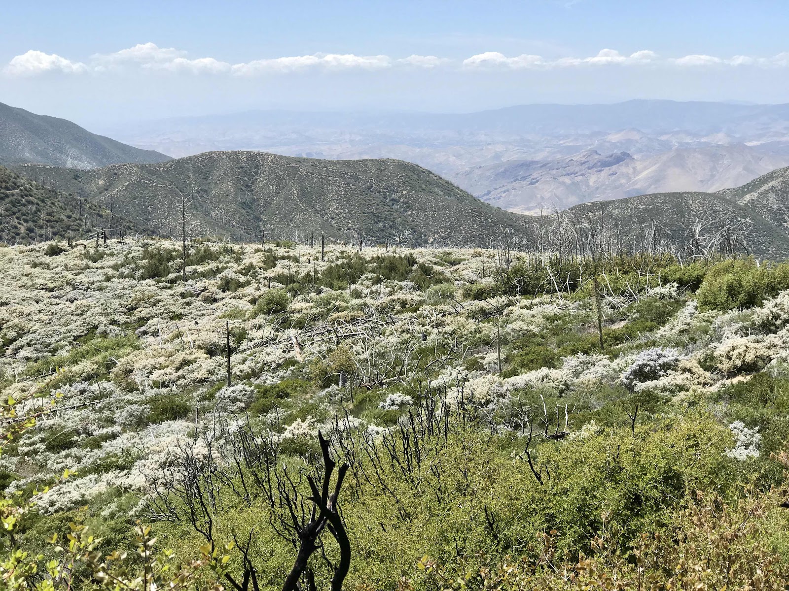
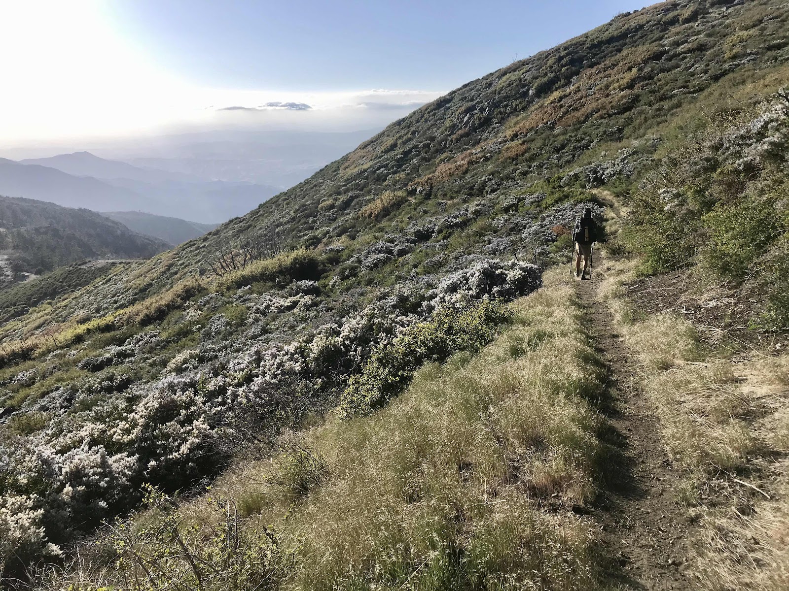
Because of the burn zone there isn’t much shade, most trees were incinerated and the vegetation growing back is all kinds of bushes. These bushes have taken over the trail and seem not to have been cut back for years. We’ve encountered a lot of overgrown trail and downed trees. Trail maintenance is not being done this year due to corona virus which we understand and accept, but this is worse than anywhere we’ve seen so far. For the first few hours of the climb, it isn't terrible, because the bushes are relatively soft, but they eventually become abrasive and thorny and we have an unpleasant time shoving our way through! Serrated oak leaves and thorny lilacs are no fun when it comes to bushwhacking. On the plus side we see tons of lilac which we’ve been seeing since Mexico, but this is probably the most abundant we’ve seen it. All day we breath lilac air and see them covering every hillside in site with their multiple shades of white and purple.
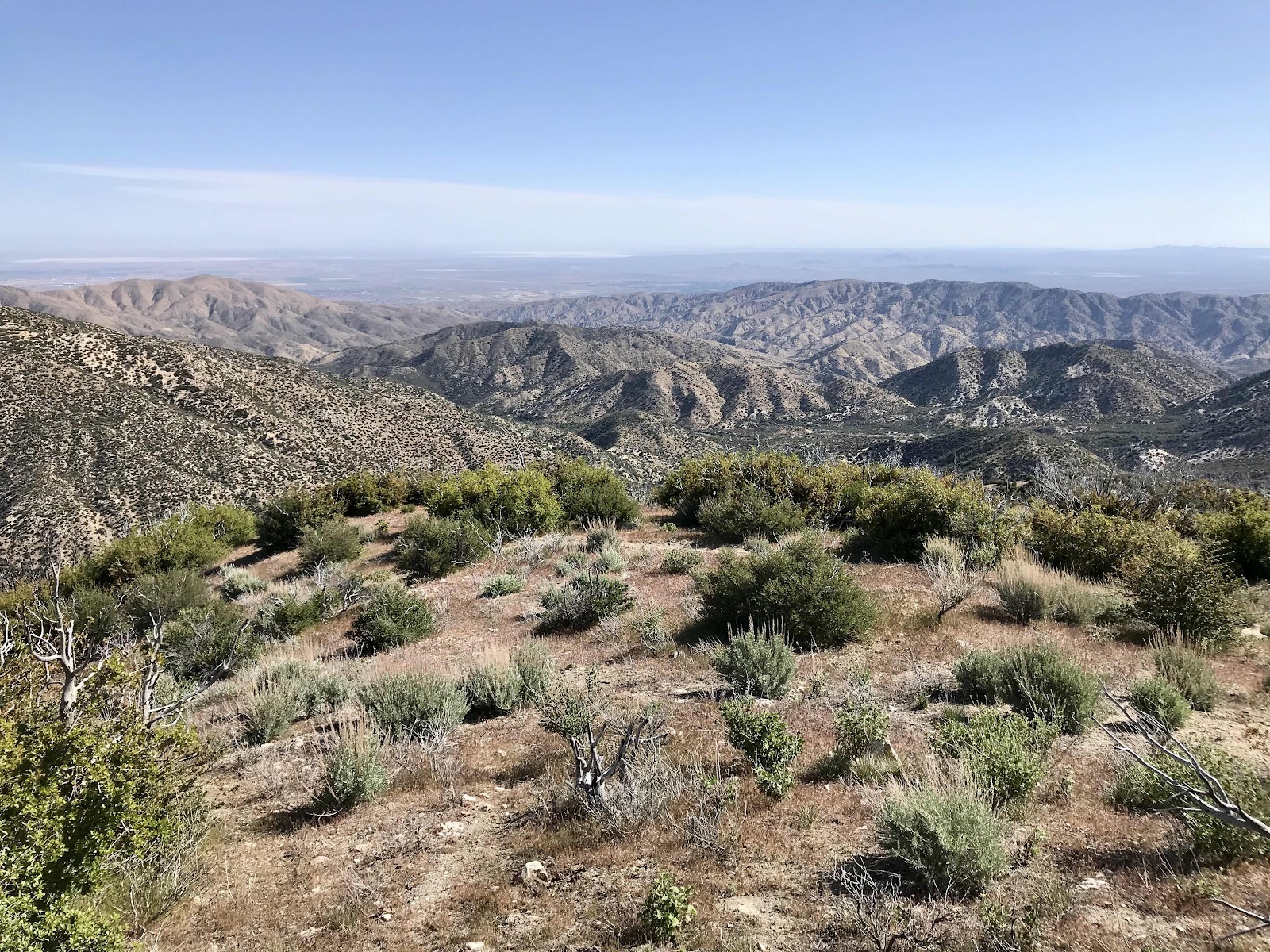
Every so often we go through a glorious patch of old growth oak trees that were spared and as we reach the top of the mountain, we find more and more trees that were spared. We see cedars, firs and several kinds of pine trees. The mountain tops out around 6,500 feet, but once again we find ourselves on a ridge just below the peak. How many peaks will we go almost to the top of?? There is an old 4wd road going to the top and many other roads that we intersected with today. This is another area we’d love to come back and explore. If there’s one thing the PCT has taught us so far, it’s how many amazing recreational opportunities there are in Southern California, that we never knew about. This area around Los Angeles as really surprised us!
From the high point we get a great view to the west of the big coastal mountains near Ventura. We see the mountain that holds the Griffith Park Observatory and the famous Hollywood sign and we can also see the upcoming mountains to the north, toward Lancaster, Mojave and Tehachapi. From the top it's just a little ways down to our desired camping spot, Messenger Flat, a primitive forest service camp that is accessible by dirt roads. The access roads are currently closed, so the only people out here are PCT hikers. The camp is situated in a small forest of pine on a saddle between 2 mountains. It's a little windy when we arrive, so we use the vestibule/entry way of the closed pit toilet to boil water on our stove for dinner! We have the place to ourselves for awhile, but then a pair of hiker girls showed up. There are probably at least 20 tent sites here and they choose to set up right next to us. Grrrr! What is wrong with people! I imagine we are probably having an unusual experience and being spoiled by general lack of people and crowding, especially in places like this that you can drive to are also somewhat close to civilization. The place should most certainly be filled with bozos in large pickup trucks with loud boom boxes and lots of noisy children running around and dog barking and pooping.
We made it 18.7 miles today!! Tomorrow is less than 14, and all downhill to the Acton KOA where we have our first mailed resupply package waiting for us. Showers, laundry and access to take out food also await.
 |
| Morning view of the mountains and valleys to the north |
 |
| Crossing the Angeles Crest Highway |
 |
| A few barely alive trees in the massive burn zone |
 |
| Skeleton trees and lilac bushes |
 |
| Some overnight tea for a variation on water |
 |
| Gooseberries, the flesh beneath the thorns is edible and tastes somewhat like kiwi |
 |
| Fields of lilac |
 |
| Wildflowers |
 |
| An evening view to the West |
 |
| The trail surrounded by lilac |
 |
| The final descent to camp |
 |
| We love picnic benches |
 |
| Dinner is served! |
 |
| We don't eat many freeze dried meals because we find they don't always rehydrate that well, they are loaded with sodium and they are expensive for tiny portions. This one is full of quinoa that seems like it was never fully cooked the first time. |


Comments
Post a Comment